Hiking in Hong Kong
Ap Lei Pai &
Brick Hill (Nam Long Shan)
Ap Lei Pai
Distance: 3.6 km Return
Time: 1 hour 40 minutes
Ascent: 420 m
Date: March 2022
Start: Lei Tung MTR
End: Lei Tung MTR

Do this hike if:
-
You're after a short, sharp escape from the city
-
You want unique views over the south of Hong Kong Island
Avoid this hike if:
-
Scrambling is not your thing
-
You prefer a stable terrain

I've decided to lump Ap Lei Pai and Brick Hill into the one post, as you can complete both of these in half a day and they are only one MTR station apart (or you could just hike the 2 km between the two trails, like I did).
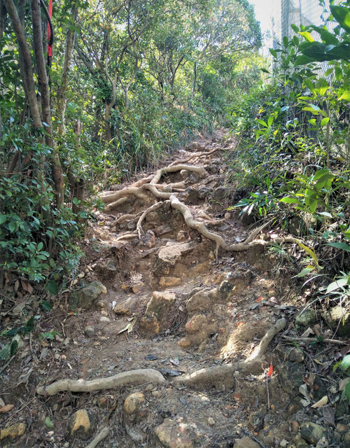
There is no warm up to Ap Lei Pai. You're heading straight up as soon as you leave the MTR station. The trail begins in a friendly manner on concrete stairs surrounded by thick vegetation, but the narrow path soon turns to dirt and rocks that appear virtually vertical. The route forks a couple of times, but each direction leads the same way: up. The sporadic ropes are a welcome sight, and I had no issues using them to hoist myself up the steep gradients. A few times some scrambling was required, so bring gloves if you don't want to get your hands dirty. I had no issues getting my hands dirty.
It wasn't long before I summitted Mt Johnston (Yuk Kwai Shan), which was devoid of any plant life taller than knee-height and offered 360-degree views. Hong Kong Island stood behind me, Ap Lei Pai (connected to Mt Johnston by a sandbar) was below, and Lamma Island sat in the deep-blue water in the distance. A World War II memorial told the story of a great escape by Allied soldiers, which made for an entertaining distraction. But I knew I couldn't stay up here forever; I had to head down.


All I can say is that I'm glad this wasn't part of a trail race, as I'm sure I would have come dead last. The descent appeared to be as precipitous as the hill I had just climbed, yet there were no ropes, no trees, nothing to stop me from hurtling downwards almost 200 metres towards the sea. To say it was slow-going is an understatement. The path was wide and there were numerous options to choose from, which was great for overtaking but terrible for picking the best route to take. The terrain ended up being more stable than it appeared (make sure you wear a good pair of trail shoes), although it didn't stop me wondering if my next step would be my last. After what seemed like an eternity, I finally set foot on the rubbish-coated sandbar at the bottom and crossed over to Ap Lei Pai. My racing heart could now relax.
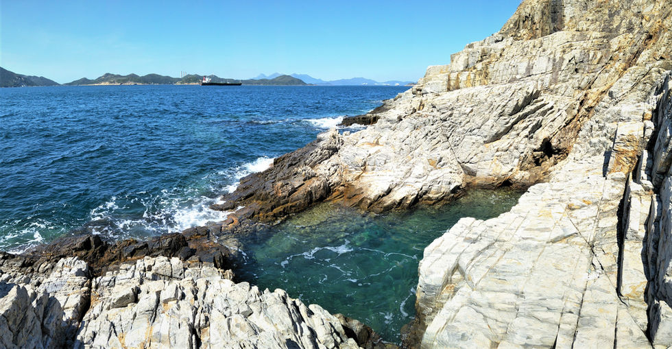
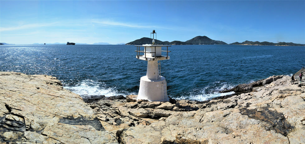
On the other side, things became much easier. There was a bit of ascent thrown in for good measure, but it was much more manageable and less nightmarish than what I had just tackled. In no time at all, I had covered the tiny island and reached the rocky beach on the southern tip. A tiny, underwhelming lighthouse marked the end of the hike, but the far-reaching views and fascinating rock formations along the coast made up for this.
After spending some time wandering up and down the shore, I reluctantly made my way back the way I came. Crossing Ap Lei Pai was easy, but it was the summit back up to Mt Johnston that I was dreading. Once again, I found the terrain to be sturdy, and it supported me well as I endured my way to the top. I'm almost certain I spent less time climbing up the mountain that I had descending it earlier. Hiker warning: beware the false summit. Just as you think you're near the peak, you realise you're only a little past halfway. It's demoralising, to say the least.
At the summit, I completed another round of photos then hesitantly began the hike back down to the starting point. The ropes (and hands) definitely got more of a workout than when I had ascended, and I wished there had been more of them (both ropes and hands). Despite my heart being in the my throat the entire time, I managed to reach the bottom without incident (other than a few scratches from the encroaching bushes).
Even though it wasn't the longest hike in Hong Kong, I feel as though it one of the steepest. I never expected a sub-4 km hike to take so long.


Brick Hill (nam Long Shan)
Distance: 5 km Return
Time: 1 hour 10 minutes
Ascent: 260 m
Date: March 2022
Start: Wong Chuk Hang MTR
End: Wong Chuk Hang MTR
Do this hike if:
-
You like a short, straightforward stair climb
-
You want to see Hong Kong Island's beaches from a different perspective
Avoid this hike if:
-
You're after a wilderness adventure
-
Stairs bore you to tears
The Brick Hill hike is a thousand times easier than Ap Lei Pai, but it still offers fantastic scenery. The first 1.5 km is all on a gently inclining road, with the only noteworthy point being a brief view of the Aberdeen marina. Once you turn off the road, however, the steps start and they don't stop. There is a mixture of concrete, rock and dirt steps, but no matter what they're made of they relentlessly head skyward. Following the path takes zero navigational skills (thankfully for me), and you'll never be alone, even on weekdays.
After a million or so steps you'll hit a pavilion, with views across the water towards Ap Lei Pai (where I had just come from) and the rides of Ocean Park. Continuing on you'll eventually hit the helipad, offering the same views but from slightly higher up. The trail ultimately ends at the summit of Brick Hill, which is occupied by antennas and cell towers, but it doesn't stop you from taking in the incredible panorama. Walking around the right-hand side of the government-controlled installations, you are rewarded with sweeping views across Deep Water Bay, Repulse Bay and beyond. It's definitely not a perspective I have experienced anywhere else on the island.
Both of these hikes are short, easily accessible and provide a decent workout with ample rewards. Although Brick Hill didn't blow me away as much as Ap Lei Pai, it is definitely worth completing both for the differing outlooks they provide over southern Hong Kong.


