Easter Island (Rapa Nui)
Chile
Easter Island, aka Rapa Nui, aka Isla de Pascua, is a tiny Polynesian landmass in the middle of absolutely nowhere. The lengthy 5.5 hour flight from Santiago felt like we had flown most of the way home to Australia. Tropical vibes hit us as soon as we stepped off the plane - palm trees, hibiscus and frangipani flowers, tropical fruits, humidity, and everything ticking along in island time. We were met by our host, given obligatory flower garlands and then driven through the sleepy town to our quiet bungalow away from the main tourist area (and civilisation in general).
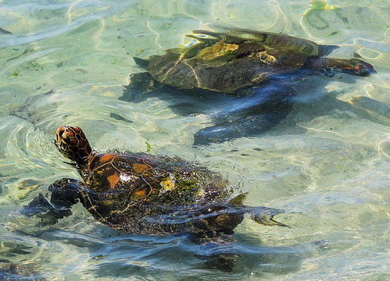
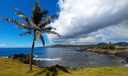
Day 1 was fairly relaxed, exploring the souvenir stores in the one and only town on the island, Hanga Roa, followed by eating local food and sipping quality cocktails. Turtles swam around those brave enough to enter the cold rock pools on the shore, while small waves crashed up and down the craggy coastline. It had been a while since we had experienced island life like this, and we quickly slipped back into the carefree swing of things.
Just a short walk up the coast was Ahu Tahai, where we caught our first sighting of the moai (i.e. giant monolithic heads) that make Easter Island famous. Most of the moai require an entrance ticket and a local guide to visit, but these ones were happily free to view. Roughly 900 moai populate the island, carved over a series of centuries out of volcanic tuff. Incomprehensibly, they were sculpted without the use of metal tools, and then skillfully moved across the island to strategic points. With an average height of 4 metres, most were placed on a stone platform looking inland, their backs to the sea. Many didn't make it, and they were left either at the base of the volcano or along the road to their intended destination. They were created in honour of the ancestors of the royal family of each tribe, with more being made when another prominent figure died (which was always the first born, male or female). Occasionally, petroglyphs were inscribed into their backs as well. Nearly all of the moai had been toppled by the 1860s for reasons unknown, but many have now been restored to their former glory. Although the moai at Ahu Tahai were a little shabby looking, you could forgive them considering they were several hundred years old. It didn’t feel real to be standing in front of the renowned figures, inducing a feeling of awe and fascination.
I returned to Ahu Tahai later in the day to catch the sunset, along with hundreds of other tourists. Of the 4 nights I watched the sunset here, on two I witnessed a proposal, and on another night a wedding ceremony took place. Seeing the moai silhouetted against the golden colours with the sea in the background was pretty romantic I guess.

On day 2 we joined our first tour, which saw us traversing across the island to visit some of the most popular sites. Up first was Ana Te Pahu, the largest cave system on the island, composed of long lava tunnels created by ancient volcanic eruptions. On the walk to the entrance we passed by numerous fruit trees, including banana, fig, avocado and guava. They grew out of openings in the earth that led straight down to the lava tubes below. Apparently, the cave provided a perfect mini-ecosystem for these trees to survive; every fruit tree we could see was standing in another hole several metres deep. We also wandered past evidence of a former village, where we were given a brief history of the housing and living practices of the Polynesian inhabitants that occupied the area centuries ago.
The cave itself was awesome. Using the torch on our phone, we moved along the tunnel from one opening to the next, each with a tree sticking out of it. Drips of water could be heard all around us, making the floor incredibly slippery. Our guide imparted more information about the cultural and cooking customs of the locals, and we saw a fire pit that was previously used for slow-cooking food wrapped in banana leaves in the hot coals.
Nearby was Ahu Akivi, a platform lined with 7 moai, facing the former village. This was the only inland platform on the island, the rest being by the coast. Known as the 7 explorers, legend says they represent 7 men sent by a king of another island to find Rapa Nui. When they arrived, they turned towards the sea, back to where they came from, and waited for the king to arrive. The moai were lying on the ground when discovered by Europeans; no one is sure why. The current theory is they were knocked over by rival tribes, but it could have easily been natural disasters. They were now upright again but in a fairly poor condition.
Orongo was a well-restored village on the southwestern tip of the island. Back in the day, it was only used during ceremonies, the most famous being the Birdman competition. This occurred in spring each year, where the most athletic member of each tribe competed to see who would rule the island for the following 12 months. It involved descending a vertical cliff wall, swimming 1.5 km to a tiny rocky islet, collecting the first egg of the sooty tern of the season, swimming back again, then climbing back up the cliff to deliver the unbroken egg. It was a successful way to stop the fighting between tribes, which continued until the 1800s. Sadly, the birds don't visit the islet anymore, due to human intervention.
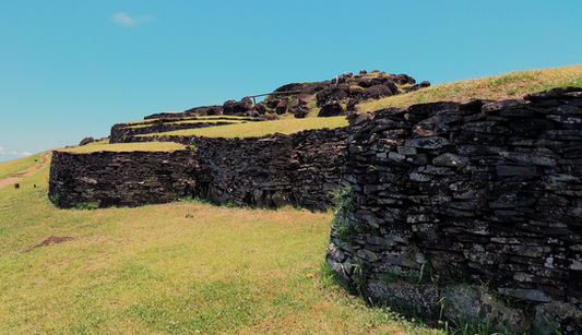
These days, the now unoccupied village of Orongo consisted of low stone huts with grass covering the roof. Each entrance was tiny, requiring the occupant to crawl in backwards to enter their dwelling. Thankfully, it was just used for sleeping, and only for a short period each year. Over time many of the houses had collapsed, possibly due to grazing animals standing on the roofs to eat the grass. Most of the houses had been restored and, as they were sitting on a ridge between a volcanic crater and the sea, the views were outstanding.
Ranu Kau was the volcano next to Orongo, with a diameter of 1.6 km. Inside the crater was a series of freshwater pools filled with long reeds, which was the main source of drinking water for the island for a long time. It was an otherworldly sight from above, like looking at the mottled surface of another planet. The side of the volcano wall near the sea had collapsed; in time, we were told, the rest of the volcano would suffer the same fate. Locals were allowed to climb down to the water and swim in the pools, but tourists were forbidden.
Our last stop was Vinapu, where there was another platform that highlighted how gifted the moai stonemasons were. The large stones fit together perfectly, reminding me of the Inca stonework in Peru. Originally, there had been a series of moai sitting on the platform, but they had fallen off centuries ago. While walking through the site we spotted a moai face partially buried in the ground, staring up at the sky. The famous red topknots, or pukao, that they sometimes bore were also dotted around the place, although they no longer looked very red. These were made from scoria, a porous volcanic rock, sourced from a site near Hanga Roa. They represented the high bun worn by the royal family, which was always dyed red as a symbol status. It was interesting, but we much preferred to see the more vertical moai.

The following day we had to ourselves, which we filled with hiking and scootering. If there a hike nearby, I'm doing it. If there's a chance to hire a scooter, Danny's doing it.
Terevaka Volcano is the highest point on the island, at just over 500 metres. It's not exactly huge, but at least it would fill a void I'd had since finishing the trekking portion of our trip over a week ago. From a distance it didn't appear to be anything special, just a broad hill that barely stood out from those around it. Rain had fallen last night and this morning, and grey clouds sat low in the sky. Despite the miserable weather conditions, we we still keen to hike up to its summit.
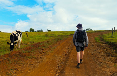
We rode our rented scooter to the start point, from where it was an easy 5 km walk along a boring, dusty road. The smell of eucalyptus hung in the air, but most of the walk was exposed to the elements. I suppose it we should have been thankful for the cloud cover, as the harsh rays had been searing into us the last couple of days. Other than a handful of cows, we had the place to ourselves.
Anticlimactically, the crater was just a grassy bowl with a sole tree growing in the centre. A little further on was the official summit, from where we were given a 360-degree panorama across the undulating pale green island. It wasn't exactly awe-inspiring, although it probably would have been more impressive on a sunny day. Out of nowhere thick clouds suddenly enveloped us, completely obliterating the view. This seemed like a sign to go down.
By the time we reached the bottom, it was blue skies all round.
Anakena Beach was significant because it was the first landing site of the Polynesians (as well as several European explorers). A line of moai stood proud at the entrance. It is the only real sandy beach on the island, although not a very large one. What it lacked in size it made up for in scenery. The shore was fringed by a plantation of palm trees, and a handful of shacks facing towards the sea sold seafood and empanadas (like every other restaurant on the island). The water was crystal clear and, in some parts, shimmered a vibrant turquoise colour. It wasn't as cold as I was expecting for the Pacific Ocean, inviting us to take a quick dip before setting off.
From Anakena we completed a loop around the island on our scooter, spotting stunning coves, petroglyphs, fallen moai and empty, crumbling platforms. The coast was mostly composed of volcanic black rocks, while inland there were just bare, grassy hills filled with farmed cows and wild horses. It was hard to imagine that when the Polynesians arrived it was almost entirely covered with palm trees. Through human and animal intervention the trees gradually disappeared, which had a catastrophic impact on the lives of the first settlers (namely, loss of food and resources leading to societal collapse). It was a shame we couldn't see it in its former glory.

Tongariki was the most popular spot on the island to watch sunrise, so we joined the obligatory tour to transport us towards the east side of the island in the early morning dark. Given that the sun didn't rise until 7.30 a.m., it actually wasn't too early of a start. Thousands of stars twinkled overhead, shooting stars streaked across the sky, and the milky way shone bright against the black of night.
The site of Tongariki is the iconic image of Easter Island, where 15 of some of the best preserved moai are lined up in front of the coast. For over an hour, we ran around the site to view the moai from every angle while the sky slowly changed colour. Having the silhouette of giant stone carvings in the foreground definitely made for a unique sunrise, although we didn’t witness a vast range of colours in the sky like we hoped.
After returning from Tongariki, I set off for the only other hike I was allowed to complete on the island without a guide, Ranu Kau. Although we visited here on our tour 2 days ago, I wanted to not only walk up the volcano (rather than be driven up) but also to view the crater from a different perspective. I knew that a narrow trail circumnavigated three quarters of the rim, and I planned to tackle most of it. Danny, on the other hand, was keen a quiet morning with lots of coffee, so he dropped me off at the start point and wished me luck.
I was very glad to have a map on my phone, as the trail I took towards the rim wasn't marked or obvious (there was more than one trail; I realised later I may have taken the wrong one). Part of the trek passed through a beautiful eucalyptus forest, the sights and smells reminding me of home. It was much more picturesque than the hike up Terevaka yesterday.
After reaching the top, I followed the undulating crater rim almost 3 km around to where it collapsed into the sea. From here I had a fantastic view of the famous Birdman island, and I could just make out the village of Orongo across the other side. It was a beautiful, peaceful location. I perched myself on a rock for quite a while, just absorbing the scenery.
On my way back around I gazed out over Easter Island, noticing that Terevaka Volcano was completely free of clouds today (of course). Out to my left was the town of Hanga Roa and the western shore, while around to the right the southern coast stretched out into eternity. Once I had taken a hundred or so photos of the crater from every angle possible, I descended all the way to town to meet Danny for a late lunch and a lazy afternoon.


On our final day, we joined another tour to tick off the remaining highlights of the island. First stop was Anakena beach, a place we had already visited on our own, but this time we were given the history of the area. The main platform consisted of 7 moai, half with red topknots, which had been found buried in the sand. Apparently there were numerous platforms underground here, all built on top of each other. Further away was another moai, all by itself, in what was clearly a different style to the first 7 (indicating it was carved in an earlier time period). This lone moai was the first statue on Easter Island to be re-erected, a feat achieved by Norwegian explorers in 1956, mainly to show that it could be done. Since then, numerous investors have funded efforts to restore other moai around the island.
Next on the itinerary was Pito Kura, the tallest moai that had arrived at its final position on a platform (there were larger ones that hadn’t left the quarry). At 11 metres in height and weighing 80 tonnes, it would have taken a mammoth effort to transport it many kilometres across the island. At some point after reaching the platform, it faceplanted the earth, broke in 2 and hadn't been touched since. Beside it was the largest topknot currently known, itself weighing 20 tonnes. It would have been the only moai on this platform, looking towards a village that now lay in ruins. Up and down the coast was evidence of further platforms, but with no moai in sight.
Although we visited Tongariki for sunrise, we received no information about the site at the time. Now we were returning to see the famous line of 15 moai during the middle of the day. All 15 had toppled over in the 17th century and broken into large pieces. In 1960, a tsunami came through and washed those pieces inland, scattering them across the land. Luckily, each of the bodies had been numbered and, using photographs, archaeologists were able to reassemble each moai and return them to the platform in their rightful positions.
Even in broad daylight, the moai still looked mightily impressive. The largest moai was 10 metres tall and weighed 60 tonnes. Only 1 topknot was positioned on the head of a moai, while several other topknots were lined up on the ground to the side. Nearby was a fallen moai that should have been on the platform too, but for some reason it didn't make the cut. Our guide pointed out petroglyphs we hadn't noticed the other morning, depicting various animals, an anchor and images associated with the Birdman competition.
Rano Raraku was by far the coolest site we visited (not in temperature - it was boiling hot in the sun). It was also the busiest, with tour groups continually inserting themselves into my photos. Rano Raraku was the quarry where all the moai were created before being 'walked' to their platforms around the island. Although we could only visit the outside of the quarry, we saw dozens of moai scattered along the slopes, most half buried in the earth. One of the first we came across was 12 metres tall, yet we could only see the top 6 metres. Apparently there were many more on the other side of the hill, but this area was off limits to tourists.
Moai, we learned, were carved straight into the rock face, the front details being completed first before moving onto the sides. Stairs were dug into the volcanic tuff, so the workers could complete as much at possible before releasing the moai from the rock at the rear. They were then cautiously slid down the hill via a shallow ditch. Our guide pointed out one of these channels to us, which was littered with abandoned moai. It's not known why they were never taken to one of the platforms.
Climbing up the slope, we came to a moai that was still partially embedded in the rock, never finished. ‘El Gigante’ was the biggest moai discovered to date, at almost 22 metres in length and weighing 220 tonnes. I think the figures alone tell you why it was left incomplete. Towards the end of the trail was one of the only moai where we could see the legs. It was constructed in a kneeling position, with its feet just visible under its bum.
Once we made it to the end, I looked back up towards the hill. It was an incredible sight, with dozens of moai faces staring back at us. I wished we could have spent longer here, but time was against us.
Ahu Akahanga is claimed to be the burial site of the first king of Easter Island, even though there is no evidence to suggest that this is true. We were taken to a small cave where there was a map of the island etched into the earth floor. It is said that the king split the island in 2 and gave half to each of his sons, as depicted in the map. Over time it was eventually separated into many tribes, who ended up fighting for the Birdman title to be crowned leader of Rapa Nui. Nearby to the cave was the second largest platform on the island, which had held 13 moai that were now lying in pieces on the ground. A couple of their topknots had recently been found in the sea. They had been lifted out by crane and were now positioned in front of the moai.
Our final stop was Vai Hu, a platform behind 8 fallen moai. In front was a ceremonial ring of stones, which is said to be a place where the inhabitants could air their grievances with those outside of their social class in a safe environment. Who knew what happened once they stepped outside the circle. Beside this was a reconstructed village, with chicken coops, vegetable gardens and models of typical houses. These were constructed using branches and shaped like an upside-down canoe, choosing this shape because boats were the only objects they knew how to build. The top was covered with thatch, and stones around the edge held the branches in place. Although it was impossible to stand up on the inside, it didn’t matter as they were only used for sleeping. All other activities in their lives occurred outdoors.

Easter Island was a welcome surprise for us. When planning the trip, I had focused so much on the moai and tourist attractions that it hadn’t even crossed my mind that we were going to a tropical island. Palm trees, beaches, fresh fruit for sale on the side of the road, great restaurants and the best cocktails we'd tasted in all of South America had made the experience even more memorable. We hadn't been sure if the expense would be worth it, but Rapa Nui delivered in every way.


