Queulat National Park
Chile
Ventisquero Colgante (Hanging Glacier)
Distance: 8.2 km
Hiking Time: 2:18 hr
Ascent: 410 m
Ventisquero Colgante, aka the Hanging Glacier, was the undisputed highlight of Queulat National Park. Unfortunately, we picked the day with the worst weather all week. Taking photos of a grey glacier sitting in front of grey clouds was never going to look impressive. We decided to wait until the afternoon to see if conditions improved.
To fill in the time, we drove out to Bosque Encantado, where a short trail through the forest would take us to Laguna Los Gnomos. We parked our car by the side of the road and took off down the path. Within 50 metres, we encountered a fast-moving river with no discernible way to cross it. We searched up and down the bank, attempting to use tree logs and rocks to our advantage, but it was all in vain. There didn't even seem to be a way to safely traverse through the water. On one unsuccessful attempt, Danny slipped straight off a tall log and fell neck-deep into the freezing cold river, drenching not only himself but also his backpack. We gave up after that.
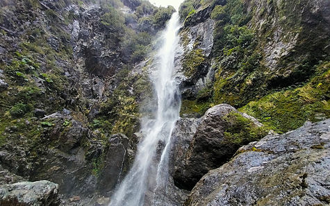
Once Danny had changed out of his saturated clothes, we stopped briefly at 2 waterfalls, both only a couple of minutes’ walk from the road (no water crossings required). Salto El Condor was a high-drop fall, with the path leading right to the base. Here I could clamour over rocks all the way up to the spray, but I think only one of us getting soaked was enough for today. The second waterfall, Cascada Padre Garcia, was much smaller but more powerful, with 2 viewpoints that were high above the action. It was a pleasant surprise that they were both free to visit, a rarity in Chile.
The weather hadn't improved by the time we arrived at Ventisquero Colgante. In fact, it had deteriorated, with a light but steady drizzle now falling. As we had already purchased our tickets (they had to be bought in advance), we decided to test our luck.
Inside the park were 5 trails of various distances out to miradors, which each showed the glacier from slightly different angles. The first route was the longest, 3.5 km uphill through a dense, deep green forest on a path consisting mostly of tree roots. At the end was supposedly the best view of the glacier, yet all we saw was a thick layer of clouds with a couple of long, forceful waterfalls spilling out the bottom. We waited around and crossed our fingers, and much to our amazement the clouds shifted briefly, exposing the full glacier and its connection to the falls. It was a hazy sight, but at least we could say that we had seen it.
Miradors 2, 3 and 4 offered us nothing but grey - not even the waterfalls could be seen. There were sightings of a greenish lake and a wide, furious river that originated from the glacier, but nothing of the ice. We didn't even bother with the last viewpoint. At this stage the rain started to pick up, causing us to give up on today and spend the rest of the afternoon rugged up indoors.

Laguna Los Pumas Trail
Distance: 10.3 km
Hiking Time: 3:55 hr
Ascent: 970 m
The following day we planned to hike the Laguna Los Pumas trail, a steep trek up to a lake by the same name. It was a 10-minute drive to the entrance of the park, where we were informed we needed to buy tickets online. Annoyingly, there was no internet or Wi-Fi available at the ranger station, unlike at other parks we had visited. Thanks to construction work that had just commenced on the road, it took us 20 minutes to drive back to the town of Puyuhuapi before we found a phone signal. We bought the tickets, got stuck in the same roadworks going back to the park, then were finally permitted to start hiking - much later than anticipated.
There was no warm up. With a gradient of over 30%, the first kilometre was a tough climb, slowing us down right from the start. A wild, unruly mess of vegetation lined the path, and tree litter covered the spongy earth. We fought off tiny insects and spider webs as we climbed higher, with nothing to gaze at but our own feet.
Around the halfway mark the incline eased off but mud and fallen trees appeared, meaning our pace wasn't much faster. We clamoured under and over trunk after trunk, while our feet sank ankle-deep into the soft sludge. Ferns and moss soon appeared, bringing a touch of beauty to the scene.
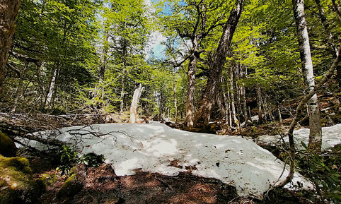
At the 4 km mark, we found large patches of snow covering the path. Luckily, faint impressions of hikers’ footsteps in recent days helped guide us to the next sections of trail. After this it was all downhill to the lake, the route becoming even more wet and slippery. Many of the bridges were a dilapidated mess, forcing us down the short slopes and up the other side.
Laguna Los Pumas was nothing special. All we could see was a smallish, nondescript lake lined by trees, with snowy mountains in the background that were shrouded in cloud. The only upside was that it was incredibly peaceful listening to the water lapping on the shore with no other sound (or people) around.
Going down wasn't much easier than the ascent, but we were so filthy by this stage that we didn't care about walking right through the middle of the mud. The steep section near the entrance was a nightmare, with our feet constantly becoming entangled in loose branches and reeds. Somehow, we made it down unscathed. Looking back, I truly enjoyed the hike, even if the lake itself had been a bit of a letdown.


